KEY ACHIEVEMENTS | BACKGROUND | PRACTICE DEVELOPMENT | RESULTS | NEXT STEPS
Key achievements
|
Background
Ongoing disruption to international travel due to COVID-19 presents significant challenges to PHE’s normal model of delivering capacity building training and workshops in country, face-to-face, with trainers from PHE’s UK-based teams generally arriving in country shortly before the training and leaving soon afterwards. These challenges have been compounded by having PHE staff who are UK nationals being out of country for extended periods of time as a result of draw-down of UK missions overseas.
 Practice Development
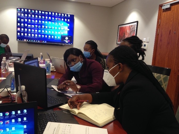
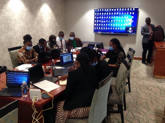
Training and capacity building activities were identified early on as those with some of the greatest potential for remote delivery. Staff from PHE’s IHR Strengthening Project in Zambia team worked in collaboration with the ZNPHI and the IHR Strengthening Project’s UK-based team to identify both new and existing training and capacity building activities that could be adapted for remote delivery and were of greatest priority to ZNPHI.
To test the viability of remote delivery of training and capacity building in Zambia and identify any potential issues ahead of any longer/larger trainings, an initial half-day training on the basics of using MS Excel for data management was delivered by UK-based IHR Strengthening Project staff, with logistics and facilitation provided by our Zambia-based team in coordination with ZNPHI. The experience gained from this training activity was used to inform the planning and delivery of a 2-day training on spatial analysis using the QGIS software package in collaboration with ZNPHI and JICA. Key learnings from the MS Excel training that improved the QGIS training included:
- Testing audio visual equipment at the training venue in advance
- The use of separate laptops to enable video calls between UK-based trainers and break-out groups of training participants
- Allocating extra time in each training session for participants to ask questions
Allocating time between each training session for the trainers to discuss how the training is progressing, identify issues and work with in-country facilitators to resolve them
 Results
Training on spatial analysis using the QGIS software package was successfully delivered and evaluated in collaboration with ZNPHI and JICA. Attendance and participation at the training indicates that remote delivery as a modality for training and capacity building activities does not appear to be a disincentive to participants. Feedback from participants and our counterparts from ZNPHI and JICA has given us confidence that we are able to deliver high-quality, effective training via remote delivery.
Spatial analysis is relevant to a number of IHR-strengthening priority areas jointly identified by ZNPHI and PHE, including emergency preparedness resilience and response, laboratory capacity, disease surveillance, chemical hazards, workforce development, and One Health. One barrier to public health institutions making spatial analysis a routine part of their work, however, is that many GIS software packages require licenses which come at a cost that may be difficult to sustain in the long term. Through training in the use of an open-source, license-free software like QGIS PHE expands access to tools for spatial analysis, and creates opportunities to further institutionalise spatial analysis for surveillance and other purposes where it is in use already.
Next steps
We are now considering how remote delivery can enable and facilitate other elements of our work beyond training and capacity building activities. For example, one potential activity will be the development of a virtual community of practice for spatial analysis across the countries the IHR Strengthening Project works in through regular webinars on both spatial analysis and the use of particular functions of QGIS software. During these webinars, participants can present work they have done, ask questions of and collaborate with each other, and receive technical advice from PHE’s delivery teams to develop their skills and encourage self-guided learning. While there are elements of face-to-face delivery that are hard to replicate, this may be at least partially compensated for by its potential to connect larger groups of participants across multiple countries and regions.
KEY ACHIEVEMENTS | BACKGROUND | PRACTICE DEVELOPMENT | RESULTS | NEXT STEPS